You are using an out of date browser. It may not display this or other websites correctly.
You should upgrade or use an alternative browser.
You should upgrade or use an alternative browser.
K9Paco
Well-Known Member
Lifetime Member
JACKAL
Ancient Honda fanboi
Moderator
Lifetime Member
Supporting Member
Club Contributor
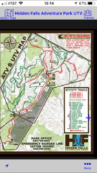
For Android devices many of us use ORUXMAP application. Information about it here.
OruxMap's - My GPS Replacement!
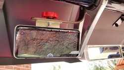
Here it is setup on a 8" Samsung Galaxy Tab A but works on any Android phone or tablet.

OruxMap's - My GPS Replacement!
Here it is setup on a 8" Samsung Galaxy Tab A but works on any Android phone or tablet.
Last edited:
Wallace
Well that didn't go as planned
Lifetime Member
K9Paco
Well-Known Member
Lifetime Member
JACKAL
Ancient Honda fanboi
Moderator
Lifetime Member
Supporting Member
Club Contributor
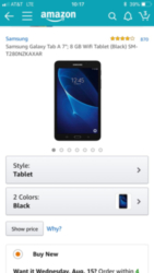
I would recommend getting the 8" 16GB version. Two reasons, the screen is better quality and the 16gb storage will ensure enough room for GPS tracks and the maps and trails you could want. Also IF you think you will use the tablet to stream music via bluetooth get the 32gb storage version.Thinking of picking up one of these for mapping and music storage. Any opinions?
Sent from my iPhone using TapatalkView attachment 83752
Just my 2 cents, I feel the 8gb might leave you waiting more space if you are going to store several states of maps and trails.
K9Paco
Well-Known Member
Lifetime Member
I would recommend getting the 8" 16GB version. Two reasons, the screen is better quality and the 16gb storage will ensure enough room for GPS tracks and the maps and trails you could want. Also IF you think you will use the tablet to stream music via bluetooth get the 32gb storage version.
Just my 2 cents, I feel the 8gb might leave you waiting more space if you are going to store several states of maps and trails.
I will be expanding the memory with an SD card so is the screen that much better? That tablet is $118 and a 64 gig card is only $30
Sent from my iPhone using Tapatalk
Last edited:
JACKAL
Ancient Honda fanboi
Moderator
Lifetime Member
Supporting Member
Club Contributor
When shopping for any mobile device you want to find out the PPI pixels per inch. The higher the number the better the screen looks. Also the type of screen a TFT is the older cheapest type where the IPS LCD is currently the better technology outside super expensive OLED
The Tab A 7" has a 160 ppi. TFT
The Tab A 8" has a 189 ppi. IPS LCD
Like anything you get what you pay for, so just know why it costs so much less it more. Just like speed, how fast can you afford to go. Longer battery life too is something to consider since you may be relying on it to get you home.
K9Paco
Well-Known Member
Lifetime Member
JACKAL
Ancient Honda fanboi
Moderator
Lifetime Member
Supporting Member
Club Contributor
Yes, pretty much all of them will.Will the Tab A stream music while I have the maps open?
Sent from my iPhone using Tapatalk
advertisement
K9Paco
Well-Known Member
Lifetime Member
100Acre
Samsquinch the Terrible Magic Bean Manipulator
Lifetime Member
Club Contributor
I use the Garmin InReach Explorer. It used to made by Delorme, but they sold out to Garmin and I've used it for years in deep backwoods areas and it has never failed me. Nonetheless, I always bring a Benchmark road and recreation atlas with me as well.
inReach Explorer+ | Garmin | Handheld Outdoor GPS


inReach Explorer+ | Garmin | Handheld Outdoor GPS
J
JTW
Guest
Yes.. I bought both of them. Started with the 7” and then later bought the 8”. I ended up keeping and using the 8”. The tech is way better. It’s faster and it has the ability to split screen with ourx maps. Meaning I can have both my Spotify and maps pulled up displaying at the same time. The 7” wouldn’t allow me to do that. Also... the biggest reason I switched was finding a waterproof case for the 7”. I finally found an otter box for the 8” so I went ahead and decided to keep it. I would also suggest the larger memory as I notice even with 128 memory card I still have quite a bit on the tablet itself.Will the Tab A stream music while I have the maps open?
Sent from my iPhone using Tapatalk
DG Rider
Member: Triple Clutch Club
Lifetime Member
I use a US Topo pro app. Mainly because i have it and paid for it a few years ago. It will let you store and area on the phone for use when there is no service.
In fact, i use and old deactivated S5 or 6 as my GPS/Camera/Go Pro remote. Not that i need any of it these days...
In fact, i use and old deactivated S5 or 6 as my GPS/Camera/Go Pro remote. Not that i need any of it these days...
W
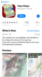
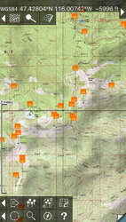
The best one I have found is Topo Maps by Brian Endecott - I think the company is Mappendix. I’ll include a screenshot of the icon and a screenshot of the program running on an iPhone.
The benefits of the app are:
1. These are the official USGS quadrangle maps.
2. There are no “in-app” purchases (once the app is purchased, you have access to USGS data forever).
3. You don’t have to supply an email address - no spam, ever.
4. You can drop pins on the map at your current location, annotate them, and have references for each ride you do.
5. No cell service required if you have pre-downloaded the maps for the region you’re in.
6. Excellent documentation within the app and on the publisher’s website.
7. You can export your pins by emailing them to yourself as a backup. I do this regularly to restore them to the app when I get a new phone, or in case my phone gets broken.


Russ989
Land of the free because of the Brave! 🇺🇸
Lifetime Member
Supporting Member
Club Contributor
I’m going to get that app for sure, looks great.The best one I have found is Topo Maps by Brian Endecott - I think the company is Mappendix. I’ll include a screenshot of the icon and a screenshot of the program running on an iPhone.
The benefits of the app are:
1. These are the official USGS quadrangle maps.
2. There are no “in-app” purchases (once the app is purchased, you have access to USGS data forever).
3. You don’t have to supply an email address - no spam, ever.
4. You can drop pins on the map at your current location, annotate them, and have references for each ride you do.
5. No cell service required if you have pre-downloaded the maps for the region you’re in.
6. Excellent documentation within the app and on the publisher’s website.
7. You can export your pins by emailing them to yourself as a backup. I do this regularly to restore them to the app when I get a new phone, or in case my phone gets broken.
View attachment 84906 View attachment 84907
K9Paco
Well-Known Member
Lifetime Member
Tramguage1
Texan
Moderator
Lifetime Member
Supporting Member
Club Contributor
If you ever want to upgrade to Lifetime trailutvmaps the larger internal store will be a plus.
also what days are you going to be at HF?
also what days are you going to be at HF?
advertisement
Similar threads
U
- Replies
- 7
- Views
- 2K
- Replies
- 5
- Views
- 1K
B
- Replies
- 2
- Views
- 1K
B


