Summer rains have started here in SW Colorado. But the weather was looking pretty good yesterday so I decided to check out Imogene pass and Yankee Boy Basin. This has been an odd year as we had so much snow last winter and such a late spring that summer has been pushed back. The mountains and streams look more like early than late summer.
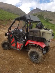
Parked and unloaded at the switch-back curve just south of Ouray. Got there about 8:30 and the parking lot was just starting to fill. Ouray doesn't allow ATV/UTVs to be ridden in town so you've got to launch from here or along county road 361.
Here's a shot heading up 361 heading towards the turn off for Imogene.

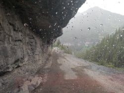
As I said there's still plenty of water pouring off the mountains.


Now above the tree line heading towards Imogene Pass summit.

At the top! 13,114 feet up and both the P500 and I were feeling the altitude. This is looking down toward Telluride and you can see the airport in the center of the frame.

Looking down into the Savage Basin you can see remnants of an aerial tramway. Just beyond were some lovely lakes and some brown shapes. Decided to drive down and investigate more.

The still standing towers.

And those brown shapes turned out to be a small herd of elk.

The only resident of these mine ruins was a marmot, also know as a whistle pig.

You can continue down to the old Tomboy mine site but past that it's a narrow shelf road leading to Telluride. Since Telluride doesn't allow ATV/UTVs in town Tomboy is a good place to turn around and head back.
A small side trail on the north side of Imogene leads to a great view back west towards Red Mountain 1 & 2. Beyond is more of the San Juans and the Weminuche wilderness.

One of the roads back down leads past the remains of Camp Bird mine.

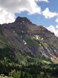
Back on CR 361 toward Yankee Boy Basin.

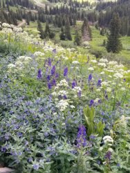
Normally peak wildflower season is mid July but it appears it's been pushed back to early Aug.

The road to the top of Yankee Boy Basin was blocked by snow about 1/4 mile before the trail head parking area. All in all, a very good day!

Parked and unloaded at the switch-back curve just south of Ouray. Got there about 8:30 and the parking lot was just starting to fill. Ouray doesn't allow ATV/UTVs to be ridden in town so you've got to launch from here or along county road 361.
Here's a shot heading up 361 heading towards the turn off for Imogene.
As I said there's still plenty of water pouring off the mountains.
Now above the tree line heading towards Imogene Pass summit.
At the top! 13,114 feet up and both the P500 and I were feeling the altitude. This is looking down toward Telluride and you can see the airport in the center of the frame.
Looking down into the Savage Basin you can see remnants of an aerial tramway. Just beyond were some lovely lakes and some brown shapes. Decided to drive down and investigate more.
The still standing towers.
And those brown shapes turned out to be a small herd of elk.
The only resident of these mine ruins was a marmot, also know as a whistle pig.
You can continue down to the old Tomboy mine site but past that it's a narrow shelf road leading to Telluride. Since Telluride doesn't allow ATV/UTVs in town Tomboy is a good place to turn around and head back.
A small side trail on the north side of Imogene leads to a great view back west towards Red Mountain 1 & 2. Beyond is more of the San Juans and the Weminuche wilderness.
One of the roads back down leads past the remains of Camp Bird mine.
Back on CR 361 toward Yankee Boy Basin.
Normally peak wildflower season is mid July but it appears it's been pushed back to early Aug.
The road to the top of Yankee Boy Basin was blocked by snow about 1/4 mile before the trail head parking area. All in all, a very good day!


