JACKAL
Ancient Honda fanboi
Moderator
Lifetime Member
Supporting Member
Club Contributor
Just got back from spending a week in TN riding the Sundquist North Cumberland OHV trails affectionately referred to as Royal Blue in general by the riders. It consists of over 200,000 acres managed by the state of TN with over 600 miles of marked trails both East & West of I-75 near Pioneer, TN and had additional trails that extend even further South all the way to Windrock (35 miles as the crow flies).
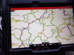
Attached are maps of all three OHV areas Sundquist, Royal Blue & New River Units
Royal Blue Resort Exit 144 East of I-75 (Sundquist Unit direct ride in)
I have been going there several years and have always enjoyed it, the DNR staff actually maintain the trails, add new ones, and re route the worst rutted sections as needed. I primarily stay at the Ride Royal Blue Resort in my camper they offer everything from day parking, tent camping, cabins, houses, as well as full hookup RV sites. Their accommodation options are here: Booking - Ride Royal Blue Resort
General resort info is here: Ride Royal Blue Resort
Other Options - Exit 141 I-75 (Sundquist & Royal Blue direct ride in)
There is Eagle Rock Resort and Campground that just opened, go 1.3 miles past El Rays Mexican Restaurant on the frontage road east side of I75, and a Comfort Inn, for fuel isa Pilot truck stop, TA Travel Center, Shell station. To eat thier is El Rays Mexican Restaurant, Popeyes Chicken, Hardee's, and a Subway at Exit 141, trail #12 comes out here and may fuel up and stay at this area as well, there is also a decent restaurant right off the trailhead of #12.
Riding fees
Are set by state of TN, the least expenses way is to purchase the small game hunting permits that allow you riding access anywhere in the state. On nice thing for SXS riders is that only one person has to buy the permit (does not have to be the driver) all passengers are free.
The fees are:
Daily out of state permit, type 038, $37.00
Daily in state permit, type 036, $15.00
Annual out of state permit combo, type 071+093, $130.00
Annual in state permit combo, type 001+093, $53.00
Age 13 and over must have a permit.
One permit per vehicle, passengers ride free.
Permits can be purchased online here:
Tennessee TWRA License
Select from the codes above, once purchased they email you a PDF file and you can print out as many copies as you want, be sure to sign each one.
The trails
There is truly everything for the family to enjoy from leisurely scenic rides through the main connector trails to moderate and very steep hill climbs to difficult rocky challenges for those that want to see if their winch is as good as advertised. Elevation runs from approx. 1100' up to 3200' The primary system trail map is attached below.
The Scenery
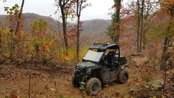
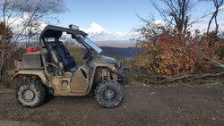
Here is a typical hillside view from the top of trail 26 in the fall:
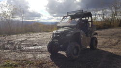
Top of the World trail 31 overlook at 3000' elevation:
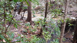
Bottom of trail 2 waterfall (one of five in the system):
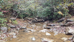
One of many scenic creek crossings:
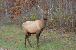
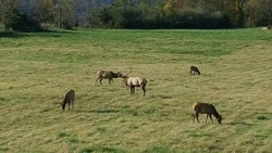
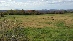
The Sundquist WMA is also home to TN Elk herd re established in 2001 that now numbers in excess of 300 strong and growing, there is even very limited hunting allowed in 6 specific regions with 1 permit each allowed annually. At the end of trail 25 is a viewing tower where the primary herd can be seen grazing almost daily in the evenings:
I wished the weather had cooperated it killed 4 days of my riding off and I didn't get to ride the Royal Blue or New River unit trails this fall but I have in the past and they will not disappoint.
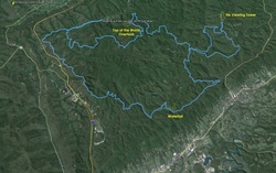
Here is the 52 mile loop I ran covering the pictures above in one 6 hour ride:
Given the costs associated with the private OHV parks of Windrock and Brimstone which charge a per person daily fee the TN public trails is 3X the size of both those combined with only 1 permit required per machine. I highly recommend giving it a try at any of the 3 locations.
This area has many more trails seamlessly connected where you can ride into Windrock Offroad park a 70,000 acres private park, and Brimstone a 50,000 acres offroad park. In all the trails run approximately 117 miles east to west and 65 miles north to south in an area encompassing 1.59 million acres. Here is an overview of the trails sheer size transposed in Google earth.

The red dot in the below picture is the approximate location of Ride Royal Blue and Eagle Rock campgrounds in relation to the trail system.

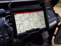
To navigate this vast area I highly recommend Lifetime Trail Maps tablets or app on your Android device. The tablets are also sold at both campgrounds as an official dealer.
See you on the trails
Attached are maps of all three OHV areas Sundquist, Royal Blue & New River Units
Royal Blue Resort Exit 144 East of I-75 (Sundquist Unit direct ride in)
I have been going there several years and have always enjoyed it, the DNR staff actually maintain the trails, add new ones, and re route the worst rutted sections as needed. I primarily stay at the Ride Royal Blue Resort in my camper they offer everything from day parking, tent camping, cabins, houses, as well as full hookup RV sites. Their accommodation options are here: Booking - Ride Royal Blue Resort
General resort info is here: Ride Royal Blue Resort
Other Options - Exit 141 I-75 (Sundquist & Royal Blue direct ride in)
There is Eagle Rock Resort and Campground that just opened, go 1.3 miles past El Rays Mexican Restaurant on the frontage road east side of I75, and a Comfort Inn, for fuel isa Pilot truck stop, TA Travel Center, Shell station. To eat thier is El Rays Mexican Restaurant, Popeyes Chicken, Hardee's, and a Subway at Exit 141, trail #12 comes out here and may fuel up and stay at this area as well, there is also a decent restaurant right off the trailhead of #12.
Riding fees
Are set by state of TN, the least expenses way is to purchase the small game hunting permits that allow you riding access anywhere in the state. On nice thing for SXS riders is that only one person has to buy the permit (does not have to be the driver) all passengers are free.
The fees are:
Daily out of state permit, type 038, $37.00
Daily in state permit, type 036, $15.00
Annual out of state permit combo, type 071+093, $130.00
Annual in state permit combo, type 001+093, $53.00
Age 13 and over must have a permit.
One permit per vehicle, passengers ride free.
Permits can be purchased online here:
Tennessee TWRA License
Select from the codes above, once purchased they email you a PDF file and you can print out as many copies as you want, be sure to sign each one.
The trails
There is truly everything for the family to enjoy from leisurely scenic rides through the main connector trails to moderate and very steep hill climbs to difficult rocky challenges for those that want to see if their winch is as good as advertised. Elevation runs from approx. 1100' up to 3200' The primary system trail map is attached below.
The Scenery
Here is a typical hillside view from the top of trail 26 in the fall:

Top of the World trail 31 overlook at 3000' elevation:


Bottom of trail 2 waterfall (one of five in the system):

One of many scenic creek crossings:

The Sundquist WMA is also home to TN Elk herd re established in 2001 that now numbers in excess of 300 strong and growing, there is even very limited hunting allowed in 6 specific regions with 1 permit each allowed annually. At the end of trail 25 is a viewing tower where the primary herd can be seen grazing almost daily in the evenings:


I wished the weather had cooperated it killed 4 days of my riding off and I didn't get to ride the Royal Blue or New River unit trails this fall but I have in the past and they will not disappoint.
Here is the 52 mile loop I ran covering the pictures above in one 6 hour ride:

Given the costs associated with the private OHV parks of Windrock and Brimstone which charge a per person daily fee the TN public trails is 3X the size of both those combined with only 1 permit required per machine. I highly recommend giving it a try at any of the 3 locations.
This area has many more trails seamlessly connected where you can ride into Windrock Offroad park a 70,000 acres private park, and Brimstone a 50,000 acres offroad park. In all the trails run approximately 117 miles east to west and 65 miles north to south in an area encompassing 1.59 million acres. Here is an overview of the trails sheer size transposed in Google earth.
The red dot in the below picture is the approximate location of Ride Royal Blue and Eagle Rock campgrounds in relation to the trail system.
To navigate this vast area I highly recommend Lifetime Trail Maps tablets or app on your Android device. The tablets are also sold at both campgrounds as an official dealer.
See you on the trails
Attachments
Last edited:


