Smittyp
Well-Known Member
Lifetime Member
Supporting Member
Adam sent me that yesterday. I'm glad I got to go a few times before they closed it.Nemo tunnel View attachment 441351
Very nice. Great read too. Thanks for taking the time to share.So Tuesday was take the Talon to the high country, mid 90's scheduled in Denver and Imma tired of the fookin' heat (Ideehoe 'bout kilt me).
Since Red Elephant Hill never gets out of the trees (altitude), I headed for Montezuma. REH is a 9/10ths ride, the first 2 miles are straight up, rocks the size of beeg block Chebby motors.Montezuma is further than my usual day rides but I got an early start ... to no avail, crash on C-470 west of Sante Fe cost me 30 minutes.
Doing the time management numbers in my head and it still seemed to work, so I stuck with it.
I picked a giant figure 8 and headed out but when I got to the bottom of Garibaldi Gulch (waypoint in photo below) I was ahead of 'schedule'. So I added Georgia Pass to my itinerary as an extra bonus loop. The advantage to that is - the escape route from GP is Glacier Ridge. GR is a 6/10ths ride until it isn't.The last 1/2 mile is pretty much straight down over the roughest, loosest, biggest boulder field I've ridden. Since I know that I'm almost out ... yeah, well that doesn't help.
It's pretty much sliding on yer ass, tryin' to miss the ones that bend things.
Ok, back up for a minit - before dropping off the ginormous rock slide, there's a side trail that's not on the map. I went about 1/2 mile on it before but was time crunched and had to bail early.Today, I decided to run that unknown spur to the end.
The End - :-| The track log shows that I made it to this exact spot before but I have no recollection of this tree -
View attachment 441654
The turn around was narrower than usual. I try to back up the bank so I can see what the front end is doing and that end has steering, a good thing. And, I got it wrong - that large boulder got in my face and I had to make a second try, getting the butt further to the left so I could complete the turn before the boulder interfered with the turn.
View attachment 441661
I'll be on that road in an hour or two. Taken from the red arrow below -
View attachment 441669
I was on the ridge at the red arrow and exited on the right, blue line.
View attachment 441672
The above photo was taken from the very top of this road -
View attachment 441673
There's still snow at 12,xxx feet on 8-20-24 -
View attachment 441675
View attachment 441680
The drop off of Radical Hill; I didn't highlight this photo in any way. The Red Cone descent and approach to Webster Pass from the NNW.
View attachment 441681
My path toward the red strike, to the left of it is one way, down hill only. I'll take a right there and come back at it from the top; an hour and a half later.
View attachment 441682
That's Radical Hill at the red strike, I just came down that ... and it's steep, narrow and off camber.
View attachment 441689
Yesterday's ride was 44.8 miles of rocks, lots of rocks. I didn't feel it while driving but when I got home, I was one whipped puppy.
Red Cone Peak, elevation 12,801 feet. I've pulled off the road, it's behind me. The road up to Red Cone is torn to sh!t because of internet exposure.
View attachment 441683
Since I can't see behind me from the driver's seat, I walked back to check out my 'backup' plan. This guy was ~40' behind me and did not GAF that I was there even though I walked toward him to get the photo. He did get pissy when I had to drive right by him to leave though and scampered off.
View attachment 441684
On the descent from Red Cone Peak, trying to show the cliff right next to the road.That's the south side of Webster Pass that I just drove down to access Red Cone.
View attachment 441685
Hanging from the seat belt on the final Red Cone descent. This is steep and why it's one-way, down only -
View attachment 441686
The SPOT log, I can't post the GAIA track because there are so many previous rides in that area as to be impossible to differentiate.
View attachment 441687
Critter bed 20' from the parking lot.
View attachment 441688
Thank you. Sometimes I wonder if I 'talk' too much.Very nice. Great read too. Thanks for taking the time to share.
The pictures make more sense when you talk. Always enjoy your posts.Thank you. Sometimes I wonder if I 'talk' too much.
I guess I can mark that off one of the places I wanted to see.Nemo tunnel View attachment 441351
Yup but if it helps you any here is pic inside the tunnelI guess I can mark that off one of the places I wanted to see.
Thanks! That is very helpful…
I took a pic in the exact same spot!
The comments make the pictures even more awesome! I wanna ride this areaThank you. Sometimes I wonder if I 'talk' too much.
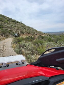
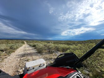
DG, I rode around with your mistress's sister here in TX the past few days. It rained on us quite a bit and was overcast the whole time. Really kept the temps and the dust down. Awesome weather for riding.Ahhh...my mistress the desert. Been a few months...
View attachment 440973
EDIT from the next day:
Was very surprised when I got back to the trailer and toggled through the trip meter and saw 98 miles!
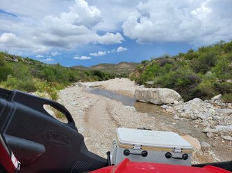
The high here in the valley was supposed to be 105. Up where this was taken it's a bit cooler, but there are spots during this loop where you drop down real low on those big washes, and it was toasty. Saw 108 while moving at one point. This is as hot as I'd ever go out. Nothing worrying, but just too hot for real enjoyment in a shadeless desert. Pioneer did fine, but I was sweating like a whore in church.
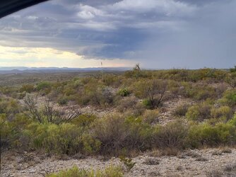
Headed over to the Gila river and splashed though it a few times for some nice relief. This immediately summoned a monsoon storm with rain hitting me for a few minutes. Rain here is always amazingly cold regardless of temps, and today it felt good.
The most amazing thing is that, in a full day of riding from around 9:30 to after dark, I only managed to take this one pic. Sometimes I just wanna unplug.
