JACKAL
Ancient Honda fanboi
Moderator
Lifetime Member
Supporting Member
Club Contributor
*************************
PICTURES FROM THE RIDE --> Pioneers on the Paiute Official Picture Thread
*************************


OK, Everyone, there will be updates during the next few weeks but wanted to get the dates out now for reservations for those that know they will go. Please consider this a working draft.
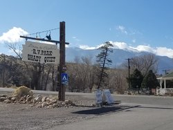
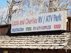
Our first Club Destination Ride will be in the Paiute Trail System with basecamp in Maryvale, Utah having Lizzie & Charlie's RV & ATV Park hosting us. All members who call please state you are with the HONDASXS.COM group ride to receive the 10% discount. There is no cancellation penalty with 14+ days notice only 50% down to hold reservation.
WHAT: HONDASXS.COM club ride in 3 million acre BLM area Paiute Trails
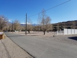
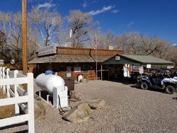
WHERE: Maryvale, Utah / Lizzie & Charlies RV Park 99 S Main St, Marysvale, UT 84750 Phone: (435) 326-4213 Lizzie and Charlie's RV and ATV Park
WHEN: September 21st through 24th 2018
Ask for Milo at the below number, mention your with Hondasxs group ride for 10% discount. Winter contact numbers below.
What to expect; This is a 2200 mile trail system in a 3 million acre riding area 12x bigger than Royal Blue, base camp elevation is 6400 ft. with highest trail on main loop at 12,400 ft. elevation several others over 10,000 ft with amazing views. Trails in general are FAR easier than Royal Blue but the scenery is beyond compare there are mining camps, cabins, old railroads to check out that have been preserved and background stories for each. Time on trails will typically be all day for decent loops from and returning to camp from 70-130 miles each day of EASY riding. Thousands on miles of side trails to explore.
This is a Pioneer 500 paradise with many 50" gated trails to explore, bigger machine can always connect with other end of 50" trails usually in good time / distance.
More info on the area see here: Multi - Ride Report - Paiute Trails / Central Utah
Cost to Ride is a $30 Annual sticker to state of Utah per machine NOT Person
The below Cabin / House spots will fill up quickly after Christmas, so reserve early if you are pretty sure you are going and need one of the cabins, RV spots will be plenty available.
To make reservations to attend call the number below, tell them you are with the HONDASXS.COM group ride for the 10% discount. Ask for Milo if leaving message, office is not staffed during winter they check messages daily and WILL return your call.
Phone: (435) 326-4213
Lizzie and Charlie's RV and ATV Park
The currently have available (Click here for detailed description of each unit ) Lizzie and Charlie's RV and ATV Park
10 - cabins that sleep 2 plus a third on a futon if needed.
2- 2 bedroom unit that sleep 4
1 - 3 bedroom unit that sleeps 8
Dozens of RV full hookup spots
6- tent camping spots
I will be there starting Monday 9/17/18 through Tuesday 9/25/2018 Anyone wanting to come longer and pre run is welcome.
Trail Maps by National Geographic these are super quality plastic coated maps HIGHLY RECOMMENDED for each machine / group going out. 708 Paiute ATV Trail (Fish Lake National Forest, BLM) Trail Map
Item [HASHTAG]#708[/HASHTAG]
708 Paiute ATV Trail (Fish Lake National Forest, BLM) Trail Map
Waterproof • Tear-Resistant • Topographic Map
With over 2,500 miles of trails and roadways available for motorized use, Fishlake National Forest is an extraordinary destination for Off Highway Vehicle (OHV) enthusiasts. National Geographic’s Trails Illustrated map of Paiute ATV Trail combines unmatched detail with helpful information to offer an invaluable tool for exploring this remarkable region of Utah. Created in partnership with local land management agencies, this expertly researched map features key areas of interest including the Tushar Mountains, Piute and Otter Creek reservoirs, the Pavant Range, Fremont Indian State Park, and a portion of Fish Lake.
In addition to the Paiute ATV Trail, the map includes portions of the Great Western Trail and the Fillmore, Marysvale, and Richfield ATV loops. Trails are clearly marked according to difficulty and with mileage between intersections to help you plan your excursions. The print version of the map includes over a dozen town access maps that include the services available in each town. The map base includes contour lines and elevations for summits, passes and lakes. Many recreation features are noted as well, including campgrounds, trailheads, interpretive trails, boat launches, and fishing areas.
Every Trails Illustrated map is printed on "Backcountry Tough" waterproof, tear-resistant paper. A full UTM grid is printed on the map to aid with GPS navigation.
Other features found on this map include: Awapa Plateau, Circleville Mountain, Delano Peak, Dixie National Forest, Fish Lake, Fishlake National Forest, Pahvant Range, Parker Mountain, Piute Reservoir, Tushar Mountains.
General Group Ride thoughts. The main loop Paiute Trail 01 is a 275 mile loop that allows for the "Loop" to be divided up into 4 quadrants for 4 days of riding, each quadrant is unique terrain, scenery. and POI's As such with the map above and the well marked trails smaller groups and go off into each quadrant elimination long lines and dust of huge groups. Due to the elevation you will typically get 20% better mileage per tank than what you experience on eastern mountain trails.
Equipment
A completely stock machine will have no problems however I would suggest full coverage skid plates due to very rocky terrain and 8 ply radial tires with a spare or a plug kit and 12v air compressor. Other than that SXS can be street legal in UTAH if yours is set up in your home state it will likely meet the requirements. Unless you are drawing unwanted attention to yourself and have the Utah OHV sticker visible on Roll Cage most LEO's will simply wave at you. I have found them to be very friendly.
Area Info Maryvale is a very small town the closest Walmart for example is in Richfield about 45 miles (a 90 min drive) There are 9 small towns in the main loop or just off of it with ATV friendly routes for food, fuel, lodging, etc. Both Richfield in NE quadrant and Beaver in SW quadrant you can drive right down off mountain trail fast food drive through and back into the trails. It can be in the 30"s when you get up and be 65 degrees by 10 AM once sun comes over mountain peak into valley. Also Snow can be common anytime above 9500 feet which is often
Last edited by a moderator:

