DG Rider
Member: Triple Clutch Club
Lifetime Member
The Bradshaw mountains of central AZ range from Sonoran desert type terrain at the southern edges, to heavily wooded pine forests complete with turkey, squirrel, and deer. Not what the typical non-Arizonian would think of when they think of Arizona.
They are also riddled with old mines. Some known, some lost and waiting to be found by me. Occasionally, someone falls into a long-forgotten mine hidden under foot...and i am sure some of those peoples' fates have never been known.
One of the central roads of the Bradshaw's is Senator highway. Do not be fooled by this name...it is anything but a hwy, and is passable high-clearance vehicles only. It gets its name from the Senator mine, which has become an almost amusement park for amateur spelunkers in the summertime, despite the dangers involved. One web site, now-defunct, on amateur exploration claimed that the Senator had "miles" of tunnels.
I've ridden Senator many times...but there is so much to explore here...and today i wanted to try a new route on a road called Golden Eagle road ( again, named after a mine ). My favorite staging area is just a few miles north of the Senator mine...
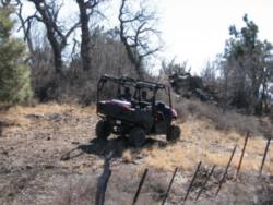
After warming up and heading off, i soon passed the Senator...and like usual, there was a Ranger parked, no doubt exploring the handy-work of man in times past. After crossing the Hassayampa creek ( soon to be a river ) in chilly weather, i turned up Walker road and found, yet again, snow and mud. I want's sure it was even slick until i hit the brakes...but the Pioneer does that trick whenever there is slop involved.
I stopped to take a pic of Hassayampa lake; A man-made damming of the Hassayampa "river" of the same name to serve the mines.
Fenced off and posted: I am amused that what was once the site of such hard labor is now the playground for the ultra rich...
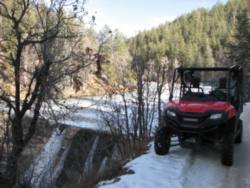
The Hassayampa_River itself is quite interesting because it flows mostly underground, and nobody seems to know quite where it comes from. I'm told that some scientists have claimed that it may flow from as far away as Nevada, but i have seen no such claims elsewhere.
After snapping a pic of the lake and dodging RZR's and Rangers, i headed on up the hill and soon crested at the junction with Poland road, then began a decent until Golden Eagle road was encountered in a sharp turn. From here on, i was in virgin territory.
Climbing to the summit saw some side roads where i rolled through between plenty of fallen firewood and silent pine needles. These all proved to be short and dead ended, so back to GE road i went, and soon created the summit, and started down the west side of the mountain.
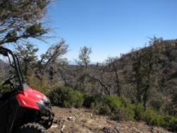
Once across, i was greeted by a blast of warmer air and spectacular views of the lower lands to the west.
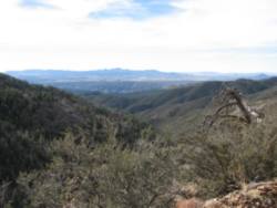
I was also greeted by a road that clearly was no longer meant for pedestrian car travel, with steep drop-offs on the lower side...
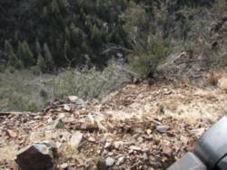
The rock also began to take on the rusty hue that signifies mineral extraction, and soon i was confronted with a side road that lead back up the mountain, and proved to have several mines...
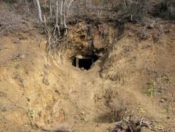
..and remnants of mans' attempts at fortune...
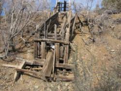
..and still more impressive views to the west...
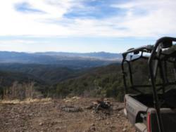
This road soon turned impressively steep and rocky, and crested at Mount Trittle, all of 7800 ft in elevation. The top of the world, with the peak very narrow...only enough for the trail...
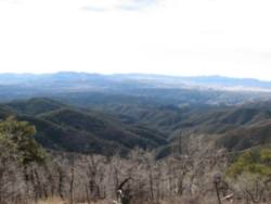
At this height, i had a hard time breathing when i took a stroll for photos. Just down from the summit was another trail that looks promising...but was impressively rough. I decided to leave this for a later date. After the ride, i would discover that this was the road i intended to take...but more in that in a minute.
Once back down the mountain and on what i thought was GE road, i quickly came upon a gate informing me that mining was still taking place here, and no one was allowed in. Bummer...and a quick end to what i thought was a long road, but looking at maps after the fact, i can see that the trail up to, and just down from the summit is actually GE road, and this is where i should have went. It was pretty gnarly, and i may save it until there is another vehicle for support in case something goes wrong.
Back up and across to Senator hwy again...scaring up what might have been a trophy buck, i took a few side trails that came to nothing, and then shot out Poland road, and after a few miles i realized that i had been on the backside before and just didn't know it.
This passes by Mt Union, with a lookout tower i have visited before on quad, but not this day. I made it to the gap below and hung out with some pretty nice cow pens...
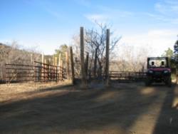
...until word came that my dogs had done their escape artist thing again, and i needed to head home to do some fence re-inforcing.
So it was that the ride was cut short. I headed back over Mt Union, over rock and through snow. Thumping along through the trees.
No doubt, the ghosts of those Pioneer's who worked this land in centuries past looked on from the shadows, wondering what this contraption was, and who piloted it.
This area is rich in history, and nearly every road-sign has a name with some sort of interesting story behind it. I've only scratched the surface here....but i will be back again.
Full album...
http://s4.photobucket.com/user/dg_rider/library/ATV/SxS ride 1-11-14?sort=3&page=1
Stuff on the area...
http://www.ghosttowns.com/states/az/poland.html
http://bradshawmountainhikes.blogspot.com/2013/05/senator-highway-walker-road-loop.html
They are also riddled with old mines. Some known, some lost and waiting to be found by me. Occasionally, someone falls into a long-forgotten mine hidden under foot...and i am sure some of those peoples' fates have never been known.
One of the central roads of the Bradshaw's is Senator highway. Do not be fooled by this name...it is anything but a hwy, and is passable high-clearance vehicles only. It gets its name from the Senator mine, which has become an almost amusement park for amateur spelunkers in the summertime, despite the dangers involved. One web site, now-defunct, on amateur exploration claimed that the Senator had "miles" of tunnels.
I've ridden Senator many times...but there is so much to explore here...and today i wanted to try a new route on a road called Golden Eagle road ( again, named after a mine ). My favorite staging area is just a few miles north of the Senator mine...
After warming up and heading off, i soon passed the Senator...and like usual, there was a Ranger parked, no doubt exploring the handy-work of man in times past. After crossing the Hassayampa creek ( soon to be a river ) in chilly weather, i turned up Walker road and found, yet again, snow and mud. I want's sure it was even slick until i hit the brakes...but the Pioneer does that trick whenever there is slop involved.
I stopped to take a pic of Hassayampa lake; A man-made damming of the Hassayampa "river" of the same name to serve the mines.
Fenced off and posted: I am amused that what was once the site of such hard labor is now the playground for the ultra rich...

The Hassayampa_River itself is quite interesting because it flows mostly underground, and nobody seems to know quite where it comes from. I'm told that some scientists have claimed that it may flow from as far away as Nevada, but i have seen no such claims elsewhere.
After snapping a pic of the lake and dodging RZR's and Rangers, i headed on up the hill and soon crested at the junction with Poland road, then began a decent until Golden Eagle road was encountered in a sharp turn. From here on, i was in virgin territory.
Climbing to the summit saw some side roads where i rolled through between plenty of fallen firewood and silent pine needles. These all proved to be short and dead ended, so back to GE road i went, and soon created the summit, and started down the west side of the mountain.
Once across, i was greeted by a blast of warmer air and spectacular views of the lower lands to the west.

I was also greeted by a road that clearly was no longer meant for pedestrian car travel, with steep drop-offs on the lower side...

The rock also began to take on the rusty hue that signifies mineral extraction, and soon i was confronted with a side road that lead back up the mountain, and proved to have several mines...

..and remnants of mans' attempts at fortune...

..and still more impressive views to the west...

This road soon turned impressively steep and rocky, and crested at Mount Trittle, all of 7800 ft in elevation. The top of the world, with the peak very narrow...only enough for the trail...

At this height, i had a hard time breathing when i took a stroll for photos. Just down from the summit was another trail that looks promising...but was impressively rough. I decided to leave this for a later date. After the ride, i would discover that this was the road i intended to take...but more in that in a minute.
Once back down the mountain and on what i thought was GE road, i quickly came upon a gate informing me that mining was still taking place here, and no one was allowed in. Bummer...and a quick end to what i thought was a long road, but looking at maps after the fact, i can see that the trail up to, and just down from the summit is actually GE road, and this is where i should have went. It was pretty gnarly, and i may save it until there is another vehicle for support in case something goes wrong.
Back up and across to Senator hwy again...scaring up what might have been a trophy buck, i took a few side trails that came to nothing, and then shot out Poland road, and after a few miles i realized that i had been on the backside before and just didn't know it.
This passes by Mt Union, with a lookout tower i have visited before on quad, but not this day. I made it to the gap below and hung out with some pretty nice cow pens...

...until word came that my dogs had done their escape artist thing again, and i needed to head home to do some fence re-inforcing.
So it was that the ride was cut short. I headed back over Mt Union, over rock and through snow. Thumping along through the trees.
No doubt, the ghosts of those Pioneer's who worked this land in centuries past looked on from the shadows, wondering what this contraption was, and who piloted it.
This area is rich in history, and nearly every road-sign has a name with some sort of interesting story behind it. I've only scratched the surface here....but i will be back again.
Full album...
http://s4.photobucket.com/user/dg_rider/library/ATV/SxS ride 1-11-14?sort=3&page=1
Stuff on the area...
http://www.ghosttowns.com/states/az/poland.html
http://bradshawmountainhikes.blogspot.com/2013/05/senator-highway-walker-road-loop.html


