Fall 2022 Arizona Peace Trail cross country trek - Planning Thread!

L

lowrider

Well-Known Member
Lifetime Member
Nov 1, 2020
1,741
3,688
113
Idaho Panhandle
Ownership

  1. 700-2
Sounds good, I was just thinking some was better than none. but all is definitely best!
This reminded me to give a call down South. My friend has a winter home on an indian res and they have not problems where he lives since the Res Police take care of security and they are not gentle so no illegals come thru there.

There are 200 to the most of around 900 per day cross the border and the majority are poor South Americans with a credit card to get into the interior of the US. Problem is the returns who have been deported previously for criminal activity to include rape robbery, murder, sexual child abuse, etc. They know the system and how to avoid getting caught again. Drug dealers are the most violent. Most seem to be crossing into CA since they are not pursued by law enforcement there but many are going into Las Vegas, NV since there are lots of targets with money. Most are gang members and joint up with friends there. I could go on.

Bottom line is hundreds per day cross the border and most are sorta harmless and seem to be funded with US based credit cards which we can only guess who is funding those cards. The former deportees are the ones who would present more of a threat. This fellow is a retired federal agent with a well known 3 letter agency and I worked with him off and on for 20 years or so and I trust his assessment of the situation. Can I say you may or may not have problem...NO but this may give you good info to base your trip on.
 
L

lowrider

Well-Known Member
Lifetime Member
Nov 1, 2020
1,741
3,688
113
Idaho Panhandle
Ownership

  1. 700-2
I live in Buckeye AZ, 2 hours away from Yuma. I havent heard anything on any uptick in crime near there or near Gila Bend, a town near the border, at least here. Gila Bend is about 30 minutes away from Buckeye. My neighbor across the street is a Border Patrol agent who works out of Ajo, AZ. He says all they see there are border crossers looking for a better quality of life. They do catch some with drugs but thats because they are forced to (mules), but thats about it. I believe anything north of the I-8 is safe imo. You guys will be ok.
I used to shoot white wing dove in Buckeye and was almost all farms. Nice area in 1973. My feeling is the big crime problem is in TX and thanks for your comments.
 
  • Like
Reactions: Biteme and Worse1
Montecresto

Montecresto

Montecresto el segundo
Lifetime Member
Supporting Member
Club Contributor
Jan 17, 2016
22,584
34,172
113
Eastern oklahoma
Ownership

  1. Other Brand

  2. 500

  3. 1000-3

  4. 1000-5

  5. Talon X4
This reminded me to give a call down South. My friend has a winter home on an indian res and they have not problems where he lives since the Res Police take care of security and they are not gentle so no illegals come thru there.
They should have been less gentle when the illegals were approaching from the east…..😂😂😂
 
  • Like
Reactions: Ohio4x4
Montecresto

Montecresto

Montecresto el segundo
Lifetime Member
Supporting Member
Club Contributor
Jan 17, 2016
22,584
34,172
113
Eastern oklahoma
Ownership

  1. Other Brand

  2. 500

  3. 1000-3

  4. 1000-5

  5. Talon X4
Please ask you friend if it would be safe to ride the upper loop, crossing along trails that parallel I-10 from Salome to Quartzsite, shortcutting the lower loop to Yuma. Maybe spend a couple days at Quartzite for some out and back rides down the western side of the loop to Cibola and back and checkout local trails to local mines.
He doesn’t know, look at what a local has to say about it…
 
  • Like
Reactions: Biteme
L

lowrider

Well-Known Member
Lifetime Member
Nov 1, 2020
1,741
3,688
113
Idaho Panhandle
Ownership

  1. 700-2
They should have been less gentle when the illegals were approaching from the east…..😂😂😂
Only a guess on my part but maybe they were native born US citizens but then it's really hard to know for sure.
 
  • Like
Reactions: Biteme
Montecresto

Montecresto

Montecresto el segundo
Lifetime Member
Supporting Member
Club Contributor
Jan 17, 2016
22,584
34,172
113
Eastern oklahoma
Ownership

  1. Other Brand

  2. 500

  3. 1000-3

  4. 1000-5

  5. Talon X4
Only a guess on my part but maybe they were native born US citizens but then it's really hard to know for sure.
Certainly native Americans knew who they were loosing their land, their culture and their lives to, but there’s other forums for this kind of conversation….
 
L

lowrider

Well-Known Member
Lifetime Member
Nov 1, 2020
1,741
3,688
113
Idaho Panhandle
Ownership

  1. 700-2
I have no intention of scaring folks.

I spent most of my professional life doing risk and threat assessments in the counterintelligence and counterterrorism world. Threats surround us daily...today I drove to get groceries and there was ice on the road. Ice presents a threat of vehicle accident/injury and you basically accept the risk of the accident and/or injury to get to your destination.

You can mitigate risk in that situation by driving slower than normal and I successfully got bread and eggs home with no mishap and didn't break any eggs. Threat and risk isn't any more complicated than that. Had I not known of the ice was there I probably would have driven at a normal speed and not dealing with the threat. Information is power and what we do with it may allow us to do the right thing...or not...your choice.
 
Montecresto

Montecresto

Montecresto el segundo
Lifetime Member
Supporting Member
Club Contributor
Jan 17, 2016
22,584
34,172
113
Eastern oklahoma
Ownership

  1. Other Brand

  2. 500

  3. 1000-3

  4. 1000-5

  5. Talon X4
A couple months ago a new staging area was built at Quartzite…..

 
Montecresto

Montecresto

Montecresto el segundo
Lifetime Member
Supporting Member
Club Contributor
Jan 17, 2016
22,584
34,172
113
Eastern oklahoma
Ownership

  1. Other Brand

  2. 500

  3. 1000-3

  4. 1000-5

  5. Talon X4
  • Like
Reactions: Biteme
advertisement
Prntckt

Prntckt

Well-Known Member
Lifetime Member
Nov 13, 2020
1,098
7,663
113
Altoona, WI
Ownership

  1. Talon X4
Saw this post on the Peace Trail Facebook page. Guy says he has secure parking by Kingman.

Mike Kelly
Im in Golden Valley Between Kingman and Bullhead on top portion of trail. Will be booking into Feb. For a camping trailer for accomadations and lots of secure parking from one rider to another!!!!

FWIW.
 
Randy6911

Randy6911

Well-Known Member
Oct 20, 2019
118
535
93
Texas
Ownership

  1. Talon X
  • Like
Reactions: Biteme and Adam490
Montecresto

Montecresto

Montecresto el segundo
Lifetime Member
Supporting Member
Club Contributor
Jan 17, 2016
22,584
34,172
113
Eastern oklahoma
Ownership

  1. Other Brand

  2. 500

  3. 1000-3

  4. 1000-5

  5. Talon X4
I just did the AZPT in 6 days.
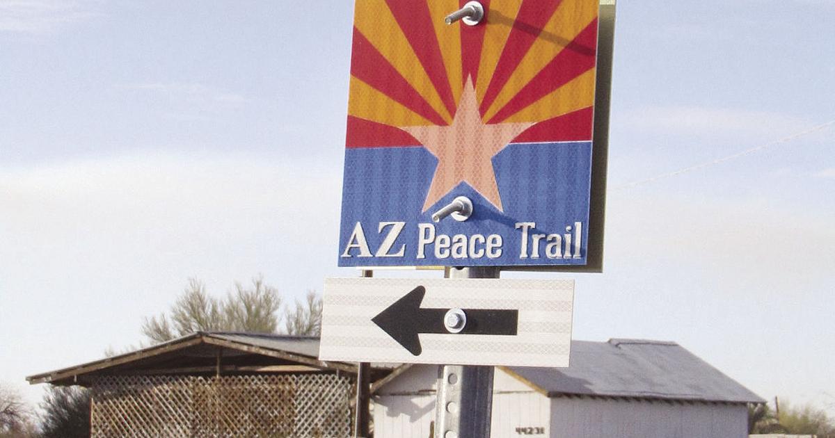
Nice. One complaint heard by some who have completed the AZPT is that it’s not marked sufficiently and some form of GPS is a must. Did it appear to you that there’s been any improvement in markers by the organization that is “caretaker” of the trail? I think that just like we have seen on other such trails, some people may be stealing signage for souvenirs.

What about side trails, say to the caves, hidden lakes or petroglyphs. I don’t see comments or pics of any of that. Were you not interested in that, or was there insufficient time for your schedule?

We will have a couple (or more) P5’s in our group, do you think loaded down P5’s will do ok?

Did you see any law enforcement along the trail or have anyone question you on street legal status? Did everyone have radios?

Oh, and did you happen to notice a trailhead parking lot in the Kingman area for the AZPT?

Thanks for your help Randy…..😎
 
Last edited:
  • Like
Reactions: Biteme
Montecresto

Montecresto

Montecresto el segundo
Lifetime Member
Supporting Member
Club Contributor
Jan 17, 2016
22,584
34,172
113
Eastern oklahoma
Ownership

  1. Other Brand

  2. 500

  3. 1000-3

  4. 1000-5

  5. Talon X4

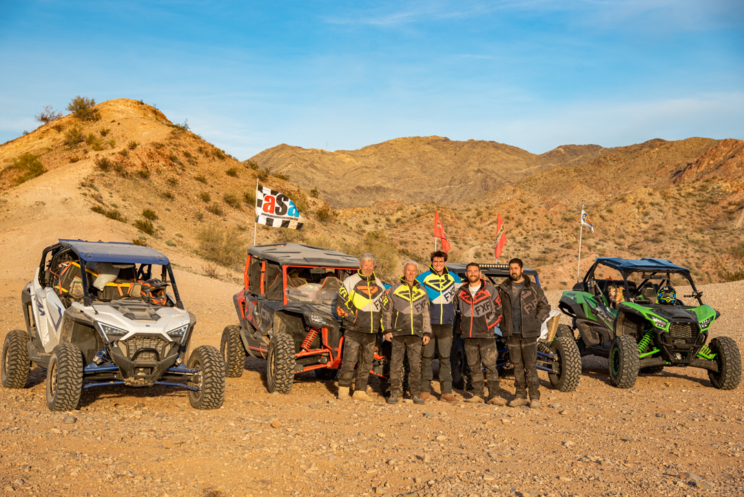
An 89 year old man accompanied these guys on their trek….😎​


Who’s ready for a 7-day, 710 mile UTV adventure?!

Story & Photos: Casey Cordeiro

If you’re looking for an epic, multi-day UTV ride that takes you through some of the best off-road scenery in the USA, look no further than the Arizona Peace Trail (APT). We recently the completed the entire Peace Trail route south of the I-40. 7 days, 6 nights, 5 nights of camping off-the-grid, 5 guys, 4 UTVs, and 710 miles of total awesomeness. “Epic” doesn’t even begin to describe the journey that the AZ Peace Trail provides! Let’s relive the journey…

 
Last edited:
Randy6911

Randy6911

Well-Known Member
Oct 20, 2019
118
535
93
Texas
Ownership

  1. Talon X
Nice. One complaint heard by some who have completed the AZPT is that it’s not marked sufficiently and some form of GPS is a must. Did it appear to you that there’s been any improvement in markers by the organization that is “caretaker” of the trail? I think that just like we have seen on other such trails, some people may be stealing signage for souvenirs.

What about side trails, say to the caves, hidden lakes or petroglyphs. I don’t see comments or pics of any of that. We’re you not interested in that, or was there insufficient time for your schedule?

We will have a couple (or more) P5’s in our group, do you think loaded down P5’s will do ok?

Did you see any law enforcement along the trail or have anyone question you on street legal status? Did everyone have radios?

Oh, and did you happen to notice a trailhead parking lot in the Kingman area for the AZPT?

Thanks for your help Randy…..😎
1. There was signage but not enough to guide you when you get into the trail. I highly recommend a good gps with a user pre mapped track to follow. You will have more trail choices along the way than you can imagine. With a group you don’t want to stop and wait at every turn or need any freelancers getting separated. I was surprised how easy it was to lose the rider in front if you weren’t close behind them. We don’t like to eat dust all day so we leave some separation between us. So many hills, valleys, turns to get lost behind. We stopped about every 30 minutes and regrouped Easily because we all used the same gpx file. We had Gaia, Avenza and other maps but the Garmin GPS was the one that worked best and easiest for us.
2. I didn’t post all the pictures of where we went. We planned and mapped our side trail adventures to match and make our planned motel stops. Choice your favorites because you can’t see everything in a week.
3. There were all kinds of machines on the trail so just about anything can make the trip. Some easier and more comfortable than others. The hardest or biggest rocky area we found was near Quartzite heading into town from the west side. I bottomed out on a few of those rocks but you will be going slow through that mile or so. Smaller tire vehicle may have more trouble but still doable. Trailers not so much.
4. Saw 2 game warden trucks, they just waved at us. No police in any town bothered us. we have license plates. There are a lot more miles of trail than police so no problem or worry for us.
5. Sorry but I didn’t look for one there. Just drove in on old Route 66 and spent the night there. Then about a 7 mile paved road south to the mountain area.

507C0C94 0647 40A0 B42A E04A7062E8CA 95494AFD EE74 405C BE73 BDFB7DD1FDA7 10450E6C C2AE 4627 8906 AE687F3EFDAA
 
Montecresto

Montecresto

Montecresto el segundo
Lifetime Member
Supporting Member
Club Contributor
Jan 17, 2016
22,584
34,172
113
Eastern oklahoma
Ownership

  1. Other Brand

  2. 500

  3. 1000-3

  4. 1000-5

  5. Talon X4
1. There was signage but not enough to guide you when you get into the trail. I highly recommend a good gps with a user pre mapped track to follow. You will have more trail choices along the way than you can imagine. With a group you don’t want to stop and wait at every turn or need any freelancers getting separated. I was surprised how easy it was to lose the rider in front if you weren’t close behind them. We don’t like to eat dust all day so we leave some separation between us. So many hills, valleys, turns to get lost behind. We stopped about every 30 minutes and regrouped Easily because we all used the same gpx file. We had Gaia, Avenza and other maps but the Garmin GPS was the one that worked best and easiest for us.
2. I didn’t post all the pictures of where we went. We planned and mapped our side trail adventures to match and make our planned motel stops. Choice your favorites because you can’t see everything in a week.
3. There were all kinds of machines on the trail so just about anything can make the trip. Some easier and more comfortable than others. The hardest or biggest rocky area we found was near Quartzite heading into town from the west side. I bottomed out on a few of those rocks but you will be going slow through that mile or so. Smaller tire vehicle may have more trouble but still doable. Trailers not so much.
4. Saw 2 game warden trucks, they just waved at us. No police in any town bothered us. we have license plates. There are a lot more miles of trail than police so no problem or worry for us.
5. Sorry but I didn’t look for one there. Just drove in on old Route 66 and spent the night there. Then about a 7 mile paved road south to the mountain area.

View attachment 314963 View attachment 314964 View attachment 314965
Great, thanks for the info. We may pick your brain more in the future…😊👍
 
  • Like
Reactions: Biteme and Pilgrim
Keebler

Keebler

Well-Known Member
Nov 1, 2020
264
891
93
St Charles, Mo
Ownership

  1. 500
1. There was signage but not enough to guide you when you get into the trail. I highly recommend a good gps with a user pre mapped track to follow. You will have more trail choices along the way than you can imagine. With a group you don’t want to stop and wait at every turn or need any freelancers getting separated. I was surprised how easy it was to lose the rider in front if you weren’t close behind them. We don’t like to eat dust all day so we leave some separation between us. So many hills, valleys, turns to get lost behind. We stopped about every 30 minutes and regrouped Easily because we all used the same gpx file. We had Gaia, Avenza and other maps but the Garmin GPS was the one that worked best and easiest for us.
2. I didn’t post all the pictures of where we went. We planned and mapped our side trail adventures to match and make our planned motel stops. Choice your favorites because you can’t see everything in a week.
3. There were all kinds of machines on the trail so just about anything can make the trip. Some easier and more comfortable than others. The hardest or biggest rocky area we found was near Quartzite heading into town from the west side. I bottomed out on a few of those rocks but you will be going slow through that mile or so. Smaller tire vehicle may have more trouble but still doable. Trailers not so much.
4. Saw 2 game warden trucks, they just waved at us. No police in any town bothered us. we have license plates. There are a lot more miles of trail than police so no problem or worry for us.
5. Sorry but I didn’t look for one there. Just drove in on old Route 66 and spent the night there. Then about a 7 mile paved road south to the mountain area.

View attachment 314963 View attachment 314964 View attachment 314965
Did you use the .gpx file off arizonapeacetrail.org or did you get one from another sources?
 
crewcabrob

crewcabrob

Well-Known Member
Lifetime Member
May 7, 2018
1,029
4,039
113
Omaha
Ownership

  1. 520
1. There was signage but not enough to guide you when you get into the trail. I highly recommend a good gps with a user pre mapped track to follow. You will have more trail choices along the way than you can imagine. With a group you don’t want to stop and wait at every turn or need any freelancers getting separated. I was surprised how easy it was to lose the rider in front if you weren’t close behind them. We don’t like to eat dust all day so we leave some separation between us. So many hills, valleys, turns to get lost behind. We stopped about every 30 minutes and regrouped Easily because we all used the same gpx file. We had Gaia, Avenza and other maps but the Garmin GPS was the one that worked best and easiest for us.
2. I didn’t post all the pictures of where we went. We planned and mapped our side trail adventures to match and make our planned motel stops. Choice your favorites because you can’t see everything in a week.
3. There were all kinds of machines on the trail so just about anything can make the trip. Some easier and more comfortable than others. The hardest or biggest rocky area we found was near Quartzite heading into town from the west side. I bottomed out on a few of those rocks but you will be going slow through that mile or so. Smaller tire vehicle may have more trouble but still doable. Trailers not so much.
4. Saw 2 game warden trucks, they just waved at us. No police in any town bothered us. we have license plates. There are a lot more miles of trail than police so no problem or worry for us.
5. Sorry but I didn’t look for one there. Just drove in on old Route 66 and spent the night there. Then about a 7 mile paved road south to the mountain area.

Thank you for all of the great info on your trip. All of us looking at this are trying to gather as much data as possible as to what will work.
 
  • Like
Reactions: Biteme and Pilgrim
crewcabrob

crewcabrob

Well-Known Member
Lifetime Member
May 7, 2018
1,029
4,039
113
Omaha
Ownership

  1. 520
Thank you for all of the great info on your trip. All of us looking at this are trying to gather as much data as possible as to what will work
 
  • Like
Reactions: Biteme
Montecresto

Montecresto

Montecresto el segundo
Lifetime Member
Supporting Member
Club Contributor
Jan 17, 2016
22,584
34,172
113
Eastern oklahoma
Ownership

  1. Other Brand

  2. 500

  3. 1000-3

  4. 1000-5

  5. Talon X4
Did you use the .gpx file off arizonapeacetrail.org or did you get one from another sources?
I’m looking at leadnav right now. We already have Gaia. Looks to me, based on reading a hell of a lot of material posted by others that have completed this trail, multiple navigation sources are a good idea….
 
  • Like
Reactions: Biteme and Pilgrim
advertisement

About us

  • Our community has been around for many years and pride ourselves on offering unbiased, critical discussion among people of all different backgrounds. We are working every day to make sure our community is one of the best.

User Menu

Buy us a beer!

  • Lots of time and money has gone into making sure the community is running the best software, best designs, and all the other bells and whistles. Care to buy us a beer? We'd really appreciate it!

    Beer Fund!

    Club Membership!